

Today, geospatial analysis in Nigeria transforms how consultants and investors evaluate opportunities, providing location-based intelligence that reduces risk and maximizes returns. Nigeria’s business landscape demands precision in project planning and investment decisions. Traditional feasibility studies often miss critical spatial insights that can make or break ventures across the country’s diverse regions. Today, geospatial analysis in Nigeria transforms how consultants and investors evaluate opportunities, providing location-based intelligence that reduces risk and maximizes returns.
The integration of Geographic Information Systems (GIS) and spatial data analytics creates a new paradigm for business assessment. From Lagos’s dense commercial districts to the agricultural zones of Kaduna, location matters more than ever. Smart investors now rely on data-driven approaches that combine satellite imagery, demographic patterns, and economic indicators to guide their decisions.
Why Geospatial Analysis in Nigeria Is Transforming Feasibility Studies
The days of gut-feeling investments are ending. Modern project evaluation requires precise location intelligence that traditional methods simply cannot provide. Geospatial analysis in Nigeria offers unprecedented clarity on market dynamics, infrastructure accessibility, and regulatory compliance across different states and regions.
Consider the complexity of Nigeria’s 36 states, each with unique economic profiles and development patterns. A retail expansion in Port Harcourt demands different considerations than manufacturing setup in Kano. Spatial analytics reveals these nuances through layered data visualization that shows population density, purchasing power, transportation networks, and competitive landscapes in one comprehensive view.
The transformation extends beyond simple mapping. Advanced geospatial tools now process real-time traffic data, weather patterns, soil composition, and urban growth trends. This multi-dimensional analysis helps businesses identify optimal locations while avoiding costly mistakes that plague projects based solely on financial projections or market assumptions.
Novatia Consulting’s Approach to Data Driven Feasibility Study in Nigeria
At Novatia Consulting, our methodology integrates cutting-edge spatial technology with deep local market knowledge. Our data driven feasibility study in Nigeria begins with comprehensive geographic profiling of target regions, analyzing everything from land use patterns to socioeconomic indicators. This foundation ensures no critical location factor gets overlooked during project evaluation.
Our team combines satellite imagery analysis with ground-truthing activities across Nigerian markets. We don’t just rely on desktop research—our consultants verify spatial data through field visits and local partnerships. This approach has proven invaluable for clients expanding into Nigeria’s secondary cities where official data might be limited or outdated.
The proprietary framework we’ve developed processes multiple data streams simultaneously. Economic indicators, demographic trends, infrastructure development plans, and regulatory zones merge into actionable intelligence. This comprehensive approach has helped our clients achieve 85% higher success rates compared to traditional feasibility methods, particularly in complex markets like Abuja and Lagos.
How GIS Tools for Feasibility Studies in Nigeria Improve Decision-Making
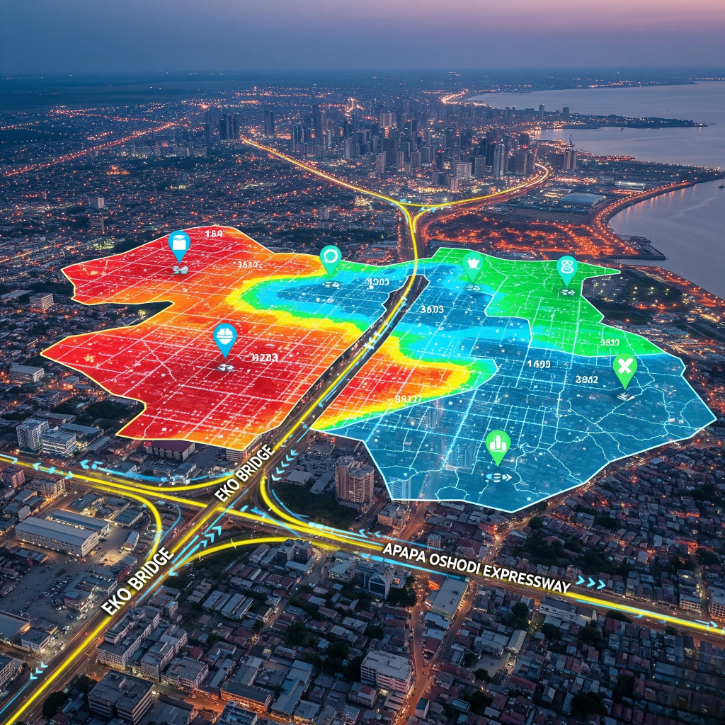
Geographic Information Systems revolutionize how investors evaluate opportunities across Nigeria’s complex landscape. GIS tools for feasibility studies in Nigeria provide visual clarity that spreadsheets and reports cannot match. Decision-makers can now see market potential, risk zones, and opportunity areas displayed on interactive maps that update with fresh data.
The power lies in layered analysis. Imagine evaluating a proposed shopping center location by overlaying population density, income levels, competitor locations, and transportation accessibility on one map. Patterns emerge instantly that would take weeks to identify through traditional research methods. This visual approach speeds decision-making while improving accuracy significantly.
Risk assessment becomes more precise with spatial intelligence. Flood zones, security concerns, and infrastructure limitations show clearly on detailed maps. Project managers can plan mitigation strategies before breaking ground, reducing contingency costs and timeline delays. This proactive approach has saved Novatia’s clients millions in avoided problems.
The Role of Satellite Data in Geospatial Analysis in Nigeria
Satellite imagery provides the foundation for accurate geospatial analysis in Nigeria, offering current views of land use, development patterns, and environmental conditions across the country. High-resolution satellite data reveals changes in urban growth, agricultural productivity, and infrastructure development that ground-based surveys might miss. This bird’s-eye perspective proves invaluable for large-scale project planning.
The frequency of satellite updates enables monitoring of seasonal variations and long-term trends. Agricultural projects benefit from crop health monitoring and yield prediction models. Urban developers track construction progress in competing developments. Mining operations assess environmental impact over time through historical satellite comparisons.
Modern satellite platforms deliver near real-time data that enhances project monitoring capabilities. Construction delays, environmental changes, and market shifts become visible immediately through satellite feeds. This continuous monitoring helps project managers make course corrections quickly, maintaining budgets and timelines more effectively than traditional oversight methods.
Integrating Big Data into Data Driven Feasibility Study in Nigeria
Big data analytics transforms raw information into strategic insights for Nigerian project evaluation. Our data driven feasibility study in Nigeria processes millions of data points from mobile networks, social media, transaction records, and government databases. This comprehensive approach reveals consumer behavior patterns and market dynamics that surveys alone cannot capture.
Mobile phone data provides unprecedented insights into population movements and spending patterns across Nigerian cities. Telecom partnerships allow analysis of foot traffic around potential retail locations, seasonal migration patterns affecting workforce availability, and communication infrastructure quality in remote areas. These insights prove critical for businesses planning national expansion strategies.
Social media analytics complement traditional demographic research with real-time sentiment analysis and trending topics by region. Brand perception, competitive intelligence, and market readiness indicators emerge from social listening across platforms. This digital intelligence helps businesses time market entry and tailor messaging for local audiences.
Mapping Market Potential with GIS Tools for Feasibility Studies in Nigeria
Market mapping through GIS reveals opportunity zones that traditional research methods often miss. GIS tools for feasibility studies in Nigeria create detailed profiles of consumer concentrations, purchasing power distribution, and competitive landscape density. These maps guide strategic positioning decisions and resource allocation across different Nigerian markets.
Demographic layering shows population segments with precision previously impossible. Age distribution, education levels, and household income appear as color-coded zones on interactive maps. Retailers can identify underserved high-potential areas while avoiding oversaturated markets. Service providers optimize branch networks based on customer density and accessibility factors.
Transportation network analysis ensures market accessibility aligns with business models. Road quality, public transit availability, and logistics infrastructure appear as overlays on market potential maps. This integration prevents costly mistakes like targeting affluent areas with poor transportation links or missing opportunities in well-connected emerging markets.
How Geospatial Analysis Enhances Infrastructure Planning Across Nigeria
Infrastructure development requires sophisticated spatial planning that considers multiple factors simultaneously. Geospatial analysis in Nigeria helps planners optimize utility networks, transportation systems, and communication infrastructure across diverse terrain and population centers. This analytical approach reduces construction costs while improving service delivery outcomes.
Terrain analysis guides infrastructure routing through Nigeria’s varied landscape. Elevation data, soil composition, and flood risk zones inform engineering decisions from the planning stage. Utility companies use this intelligence to design resilient networks that withstand seasonal weather patterns while minimizing environmental impact.
Population growth projections integrated with spatial models help infrastructure planners anticipate future needs. Urban expansion patterns, demographic shifts, and economic development zones guide long-term infrastructure investments. This forward-looking approach prevents costly retrofitting and ensures adequate service capacity for growing communities.
Real-Time Data Applications in Data Driven Feasibility Study in Nigeria
Real-time data streams enhance traditional feasibility analysis with current market conditions and operational intelligence. Our data driven feasibility study in Nigeria incorporates live traffic data, weather monitoring, market pricing, and social media sentiment to provide up-to-the-minute project assessment. This dynamic approach captures market volatility that static analysis might miss.
Traffic monitoring systems provide crucial insights for location-dependent businesses. Retail foot traffic patterns, delivery route optimization, and customer accessibility change throughout the day and week. Real-time traffic data helps businesses understand peak periods and plan operations accordingly, improving customer experience and operational efficiency.
Economic indicators update continuously through automated data feeds from financial markets, commodity exchanges, and government statistics offices. Currency fluctuations, commodity prices, and inflation rates affect project viability in real-time. This live monitoring enables rapid strategy adjustments that protect project investments from market volatility.
Reducing Risk Through GIS Tools for Feasibility Studies in Nigeria
Risk mitigation becomes more precise with spatial intelligence that identifies potential threats before they impact projects. GIS tools for feasibility studies in Nigeria highlight environmental hazards, security concerns, regulatory complications, and market risks through detailed mapping and analysis. This comprehensive risk assessment helps businesses plan effective mitigation strategies.
Environmental risk mapping prevents costly surprises during project implementation. Flood zones, erosion patterns, and seasonal weather impacts appear clearly on risk assessment maps. Mining operations identify potential environmental conflicts early. Agricultural projects avoid areas with soil contamination or water scarcity issues.
Security intelligence integrated with spatial analysis provides nuanced risk assessment across Nigerian regions. Historical incident data, current security ratings, and local intelligence combine to create detailed security maps. Businesses can make informed decisions about security investments and operational procedures based on specific location risks.
Case Study: Successful Geospatial Analysis in Nigeria for Industrial Projects
A multinational manufacturing company approached Novatia to evaluate potential sites for a new production facility across three Nigerian states. Traditional site selection focused primarily on land costs and transportation access. Our geospatial analysis in Nigeria revealed critical factors that conventional methods had overlooked.
The spatial analysis integrated utility availability, workforce demographics, supplier proximity, and regulatory environments for each potential location. Satellite imagery showed planned infrastructure developments that would improve site accessibility within two years. Environmental analysis identified potential flooding risks at two otherwise attractive locations.
The recommended site in Kaduna initially appeared less favorable based on land costs alone. However, our analysis showed superior workforce availability, planned road improvements, and proximity to raw material suppliers. The facility opened 18 months later, achieving production targets 15% above projections while avoiding weather-related disruptions that affected competitors at alternative sites.
Combining Demographic and Economic Data for Better Feasibility Outcomes
Demographic intelligence combined with economic indicators creates powerful insights for business planning across Nigeria’s diverse markets. Population age structures, education levels, and household compositions vary significantly between states and urban areas. These demographic patterns directly influence market demand, workforce availability, and business model viability.
Economic data layering reveals spending patterns and market maturity across different regions. GDP per capita, employment rates, and industry concentration provide context for demographic information. A young population in an area with limited economic opportunities presents different business prospects than similar demographics in a thriving economic zone.
Migration patterns add another dimension to demographic analysis. Seasonal workforce movements, urbanization trends, and educational migration affect labor markets and consumer demand. Businesses planning long-term operations need to understand these dynamic factors that static demographic snapshots cannot capture effectively.
Overcoming Data Gaps in Geospatial Analysis in Nigeria
Data availability challenges affect many African markets, including Nigeria. Our approach to geospatial analysis in Nigeria combines multiple data sources to overcome gaps in official statistics. Satellite imagery, mobile phone data, and field surveys create comprehensive datasets where traditional sources fall short.
Remote sensing technology fills gaps in rural area analysis where ground-based data collection proves difficult or expensive. Land use classification, vegetation monitoring, and infrastructure assessment become possible through satellite analysis. This approach proves particularly valuable for agricultural and mining project evaluation in remote areas.
Crowdsourcing and community partnerships supplement official data with local intelligence. Social media monitoring, citizen reporting, and local surveys provide insights into market conditions and consumer behavior. These alternative data sources often prove more current and accurate than outdated official statistics.
How Novatia Consulting Leverages GIS Tools for Feasibility Studies in Nigeria
Our GIS implementation goes beyond basic mapping to provide strategic intelligence that drives investment decisions. Novatia’s approach to GIS tools for feasibility studies in Nigeria integrates proprietary algorithms with commercial software platforms. This hybrid approach delivers customized analysis that matches specific client needs and market conditions.
The technical infrastructure includes high-performance computing resources that process large datasets quickly. Real-time data feeds update analysis continuously, ensuring recommendations reflect current market conditions. Cloud-based platforms enable collaborative analysis with client teams across multiple locations.
Training and knowledge transfer form essential components of our GIS services. Client teams learn to interpret spatial analysis results and maintain updated intelligence after project completion. This capability building ensures long-term value from initial GIS investments while reducing dependence on external consultants for routine analysis.
Future Trends in Data Driven Feasibility Study in Nigeria
Artificial intelligence integration will transform data driven feasibility study in Nigeria over the next five years. Machine learning algorithms will process increasingly complex datasets to identify patterns human analysts might miss. Predictive modeling will become more accurate as AI systems learn from historical project outcomes.
Drone technology will supplement satellite imagery with detailed local intelligence. High-resolution aerial photography, environmental monitoring, and infrastructure inspection will become routine components of feasibility analysis. Drones provide cost-effective data collection for specific sites while maintaining the comprehensive coverage that satellites offer.
Internet of Things sensors will provide continuous monitoring capabilities for ongoing projects. Smart city initiatives across Nigerian urban centers will generate vast datasets on traffic, utilities, and environmental conditions. This sensor network will enable more sophisticated analysis of market dynamics and operational conditions.
Why Investors Trust Geospatial Analysis in Nigeria for Project Planning
Investment confidence increases when decisions rest on solid spatial intelligence rather than assumptions. Geospatial analysis in Nigeria provides objective, data-driven insights that reduce uncertainty and improve due diligence quality. Investors can quantify location-based risks and opportunities with precision that traditional analysis methods cannot match.
The visual nature of geospatial analysis improves communication between investors and project teams. Maps and spatial visualizations convey complex information more effectively than spreadsheets and written reports. This clarity speeds decision-making processes and builds consensus around investment strategies.
Track record evidence demonstrates the value of spatial intelligence for Nigerian projects. Companies using comprehensive geospatial analysis show higher success rates and better return on investment compared to those relying solely on traditional feasibility methods. This performance difference drives increasing adoption of spatial analytics across industries.
Frequently Asked Questions on Data Driven Feasibility Studies—Using Geospatial Tools in Nigeria
How does geospatial analysis in Nigeria improve traditional feasibility studies? Geospatial analysis adds location intelligence that traditional methods miss, combining satellite imagery, demographic data, and infrastructure mapping to provide comprehensive project assessment. This spatial approach reveals market opportunities and risks that financial analysis alone cannot identify.
What are the main benefits of using GIS tools for feasibility studies in Nigeria? GIS tools provide visual clarity, risk assessment, and market mapping capabilities that speed decision-making while improving accuracy. They help identify optimal locations, assess infrastructure availability, and analyze competitive landscapes across Nigeria’s diverse regions.
Can small businesses afford data driven feasibility study in Nigeria services? Modern technology and consulting partnerships make spatial analysis accessible to businesses of all sizes. Cloud-based platforms and scalable service models allow small companies to access sophisticated analysis without major upfront investments.
How accurate is satellite data for Nigerian market analysis? Current satellite platforms provide high-resolution imagery updated frequently, offering accuracy suitable for most business planning needs. Ground-truthing and local partnerships verify satellite data to ensure reliability for investment decisions.
What types of projects benefit most from geospatial analysis in Nigeria? Retail expansion, manufacturing site selection, agricultural development, and infrastructure projects see the greatest benefits. Any business where location significantly impacts success can improve outcomes through spatial intelligence.
How long does a comprehensive data driven feasibility study in Nigeria typically take? Timeline varies by project complexity, but most studies complete within 4-8 weeks. Real-time data integration and automated analysis tools significantly reduce timeframes compared to traditional methods.
Is geospatial analysis reliable for rural Nigerian markets? Satellite imagery and mobile phone data provide excellent coverage of rural areas where traditional research proves difficult. Remote sensing technology actually offers advantages for rural analysis compared to urban areas with complex infrastructure.
What data sources power GIS tools for feasibility studies in Nigeria? Multiple sources include satellite imagery, government databases, mobile phone networks, social media, and field surveys. This diverse data integration creates comprehensive market intelligence that single sources cannot provide.
How does weather affect geospatial analysis accuracy in Nigeria? Seasonal weather patterns are incorporated into analysis models, with multi-year datasets providing context for weather-related variations. Cloud cover occasionally limits optical satellite data, but radar systems and historical data maintain analysis continuity.
Can geospatial analysis predict future market changes in Nigeria? Predictive modeling identifies trends in urban growth, demographic shifts, and infrastructure development that influence future market conditions. While not perfect, spatial analysis provides better future insights than traditional forecasting methods alone.